Buoys are critical navigation aids that help seafarers safely transit through coastal waters, channels, and hazardous zones.
From marking safe passage to indicating danger, these floating markers guide ships day and night.
In this guide, we’ll break down the 30 most common types of buoys you’ll encounter at sea, organized by purpose and system, so you can quickly identify them on charts or during bridge watch.
❓ What Are Marine Buoys?
Marine buoys are floating structures anchored to the seabed that serve as visual markers in maritime navigation. They indicate:
- Safe or hazardous waters
- Channel directions and boundaries
- Wreck sites and underwater cables
- Scientific and environmental monitoring points
Each buoy has specific shapes, colors, topmarks, and light signals.
These characteristics convey important information to mariners, often forming part of the IALA Buoyage System used worldwide.
🧭 A. The IALA Buoyage System (Region A & B)
The International Association of Marine Aids to Navigation and Lighthouse Authorities (IALA) created a standardized buoyage system divided into Region A and Region B:
| Region | Port Side Buoy (Inbound) | Starboard Side Buoy (Inbound) |
| A | Red | Green |
| B | Green | Red |
✅ Region A includes Europe, Africa, Asia, and most of the world. Region B includes the Americas, Japan, the Philippines, and South Korea.
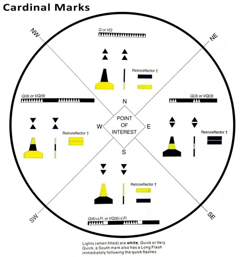
🌍 Cardinal Marks
Cardinal marks indicate the safest water lies to the north, east, south, or west of a danger. They’re recognized by their black and yellow color scheme and double cone topmarks.
| Cardinal Buoy | Color Pattern | Topmark | Safe Water Direction |
| North | Black over Yellow | ▲ ▲ (Both Up) | North of the mark |
| East | Black-Yellow-Black | ▲ ▼ (Away from each other) | East of the mark |
| South | Yellow over Black | ▼ ▼ (Both Down) | South of the mark |
| West | Yellow-Black-Yellow | ▼ ▲ (Pointing inward) | West of the mark |
🔍 These buoys are vital when passing off-shore hazards or isolated dangers near shipping routes.
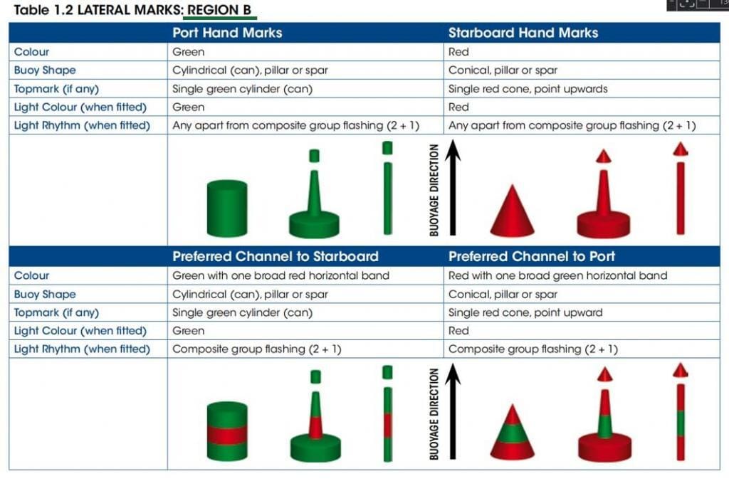
🟥 Lateral Marks
Lateral buoys mark the sides of navigable channels, guiding inbound and outbound traffic depending on the IALA region.
Region A (most of the world):
- Port Hand Buoy: Red, can-shaped (cylindrical), marks the left side when entering a harbor.
- Starboard Hand Buoy: Green, conical, marks the right side when entering a harbor.
Region B (e.g., the Philippines, Americas):
- The colors are reversed: Green = Port, Red = Starboard when inbound.
| Buoy Type | Shape | Color (Region A) (Inbound) | Light |
| Port Hand | Can | Red | Red flashing (any rhythm) |
| Starboard Hand | Cone | Green | Green flashing (any rhythm) |
✔️ Preferred Channel Mark (Bifurcation Buoy)
This buoy marks a junction in a channel, showing the preferred (main) route.
It combines the colors of lateral marks, with the top color indicating the preferred channel.
Example: Red with a green band = preferred channel is to port.

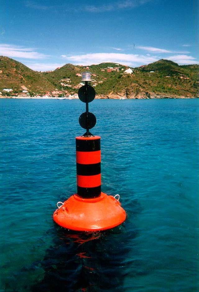
⚠️ Isolated Danger Mark (IDM)
These buoys indicate a hazard surrounded by safe water– like rocks or sunken ships.
- Color: Black with a red horizontal band
- Topmark: Two black balls (vertical alignment)
- Light: Group flashing (2 white flashes)
📍 IDMs are placed directly over or beside the danger. Always steer well clear.
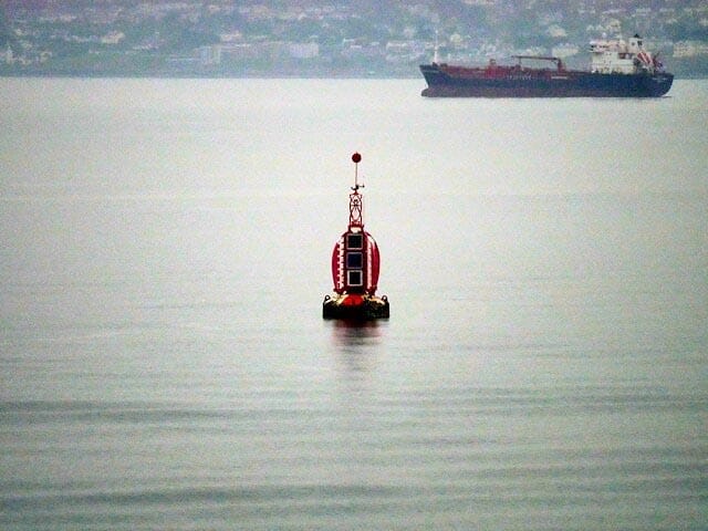
✅ Safe Water Mark
This buoy marks clear, navigable water all around. It’s commonly found at landfall positions or mid-channel.
- Color: Red and white vertical stripes
- Topmark: Single red sphere
- Light: Isophase (equal light/dark), occulting, or Morse “A”
✅ Safe Water Marks are ideal visual references when approaching from the open sea.
🚨 Emergency Wreck Marking Buoy
Used to mark new wrecks that are not yet charted, deployed within 72 hours of a maritime incident.
- Color: Alternating blue and yellow vertical stripes
- Topmark: Upright yellow “St. Andrew’s Cross” (if fitted)
- Light: Alternating yellow and blue flash (1 sec. each)
⚠️ These buoys are temporary but critical to identify during emergency or rescue operations.

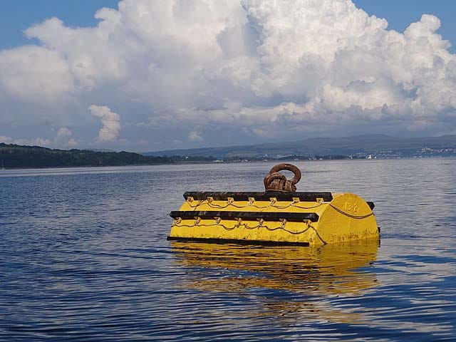
🔶 Special Marks (Yellow Buoys)
Special marks are yellow-colored buoys used to convey information not related to channel navigation.
They often indicate administrative areas, data collection points, or restricted zones.
These buoys usually have:
- Color: Yellow
- Topmark: Yellow “X” (St. Andrew’s Cross)
- Light: Yellow flashing (various rhythms)
Always refer to your nautical chart for exact meaning.
📍 Common Types of Special Buoys
| Buoy Type | Purpose |
| Anchorage Buoy | Marks designated anchoring zones |
| Mooring Buoy | Used for vessel tie-up/ mooring operation; often barrel-shaped |
| Swimming Area Buoy | Denotes safe zones for swimmers |
| Spoil Ground Buoy | Marks areas where dredged material is dumped |
| No Anchoring / Keep Out Buoy | Prohibits anchoring or vessel entry |
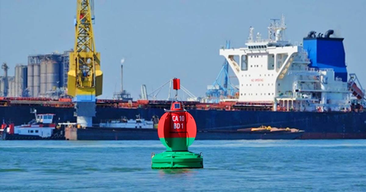
| Controlled Area Buoy | Marks zones under control (e.g., military use) |
⚓ These buoys protect sensitive areas or enforce regulations. Violating their instructions may result in legal penalties or vessel damage.
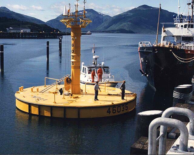
🌐 B. Data Collection and Monitoring Buoys
Buoys today aren’t just passive markers, they’re part of intelligent maritime systems.
Here are modern scientific and environmental buoys you may encounter.
| Buoy Type | Description |
| Weather Reporting Buoy | Collects meteorological data (wind, pressure, temp.) |
| Oceanographic Buoy (ODAS) | Gather ocean data (currents, salinity, etc.) |
| Wave Measurement Buoy | Measures wave height, period, and direction |
| Oil Spill Monitoring Buoy | Tracks pollution and oil spill movement |
| Research Buoy | Records multiple parameters for marine studies |
| Ice Buoy | Tracks sea ice movement and thickness |
| Fishery Research Buoy | Studies fish behavior, migration, water conditions |
🛰 Many of these buoys transmit real-time data to satellites, aiding navigation, fisheries, and environmental safety.
🛥️ C. Operational and Zone-Specific Buoys
Buoys are also used to demarcate areas for navigation operations, installations, or maritime events.
| Buoy Type | Purpose |
| Regatta Buoy | Marks race course for sailing or yachting |
| Mussel Farm Buoy | Indicates shellfish farming zones |
| Naval Exercise Buoy | Shows military drill zones |
| Underwater Cable Buoy | Marks presence of subsea cables (no anchoring!) |
| Installation Buoy | Denotes oil rigs, pipelines, or wind farms |
⚠️ Do not anchor or fish in these areas without clearance. They often involve submerged hazards or restricted operations.
🧭 D. Temporary and Drifting Buoys
Some buoys are not permanent and are deployed for short-term or mobile use.
| Buoy Type | Use Case |
| Drift Buoy | Released to track ocean currents and drift patterns |
| Temporary Buoy | Marks temporary hazards or construction zones |
🧪 Drift buoys are often used by navies and researchers to study sea movement in real time.
📋 Summary: Full List of 30 Buoy Types Used in Maritime Navigation
Here’s a quick reference of all 30 buoy types mentioned in this guide:
- North Cardinal Buoy
- East Cardinal Buoy
- South Cardinal Buoy
- West Cardinal Buoy
- Port Hand Buoy
- Starboard Hand Buoy
- Preferred Channel Buoy
- Isolated Danger Mark
- Safe Water Mark
- Emergency Wreck Marking Buoy
- Anchorage Buoy
- Mooring Buoy
- Swimming Area Buoy
- Spoil Ground Buoy
- No Anchoring / Keep Out Buoy
- Controlled Area Buoy
- Weather Reporting Buoy
- Oceanographic Buoy (ODAS)
- Wave Measurement Buoy
- Oil Spill Monitoring Buoy
- Research Buoy
- Ice Buoy
- Regatta Buoy
- Mussel Farm Buoy
- Naval Exercise Buoy
- Underwater Cable Buoy
- Fishery Research Buoy
- Drift Buoy
- Installation Buoy
- Temporary Buoy
✅ Why Knowing Buoys Matters for Seafarers
Many navigational incidents occur due to misinterpretation or lack of knowledge about buoy markers.
Understanding buoy types is a critical part of:
- Passage planning
- Safe navigation
- Bridge watchkeeping
- Collision and grounding avoidance
Modern coastlines are getting increasingly complex.
Fisheries, construction, conservation zones, restricted areas, and buoys are your first line of visual guidance.
Don’t just rely on ECDIS or radar; visual buoy recognition remains a fundamental bridge skill.
📌 Final Thoughts: Learn the Language of the Sea
Buoys aren’t just floating objects, they’re a language used to guide, warn, and protect every mariner at sea.
As part of your navigation routine, always cross-check buoy locations on your nautical chart, verify their light characteristics, and understand their message before proceeding.
🧭 Want to master the IALA buoyage system?
👉 Read our full guide here (IALA Buoyage System Explained: Region A vs. B, Cardinal Buoys, and More!)
📥 Bonus: Get Your Printable Buoy Recognition Cheat Sheet
Comment down if you need one or message us and we’ll send it to you! Perfect for cadets, deck officers, and anyone preparing for a bridge watch!
May the winds be in your favor.
Leave a Reply